Greenland is a big island -- about the size of Saudi Arabia -- covered by ice and snow. But climate experts agree that frozen ground cover is melting at an accelerating pace, raising the sea level.
Greenland Icemelt
5
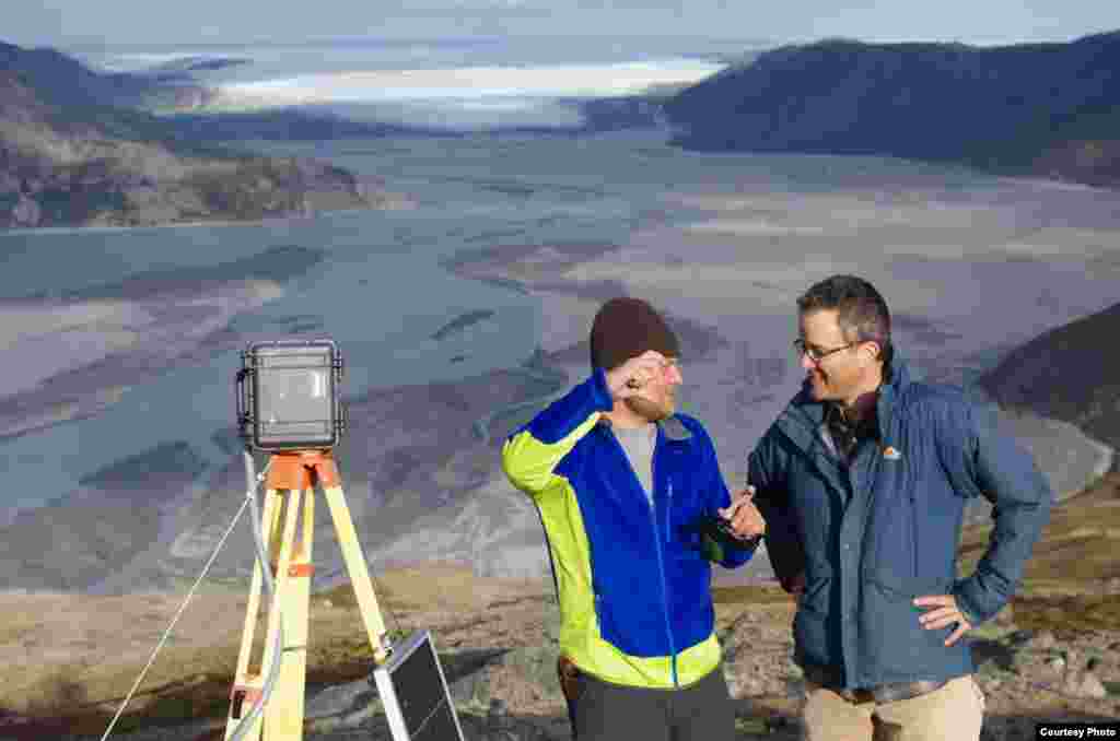
UCLA geography graduate student Lincoln Pitcher (left) and UCLA geography professor Laurence C. Smith overlook the mighty Isortoq River, where meltwater leaves the Greenland ice sheet to flow to the ocean seen in the distance. (UCLA/Laurence C. Smith)
6
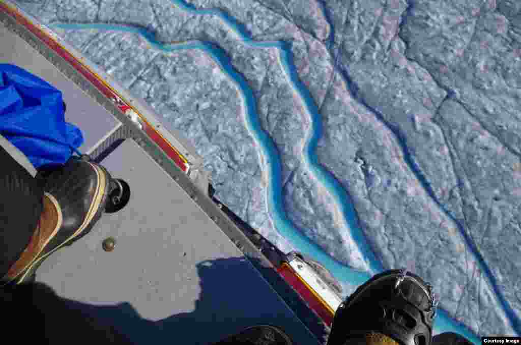
Conditions were so risky on the ground that researchers surveyed the ice sheet from the safety of a helicopter. (UCLA/Laurence C. Smith)
7
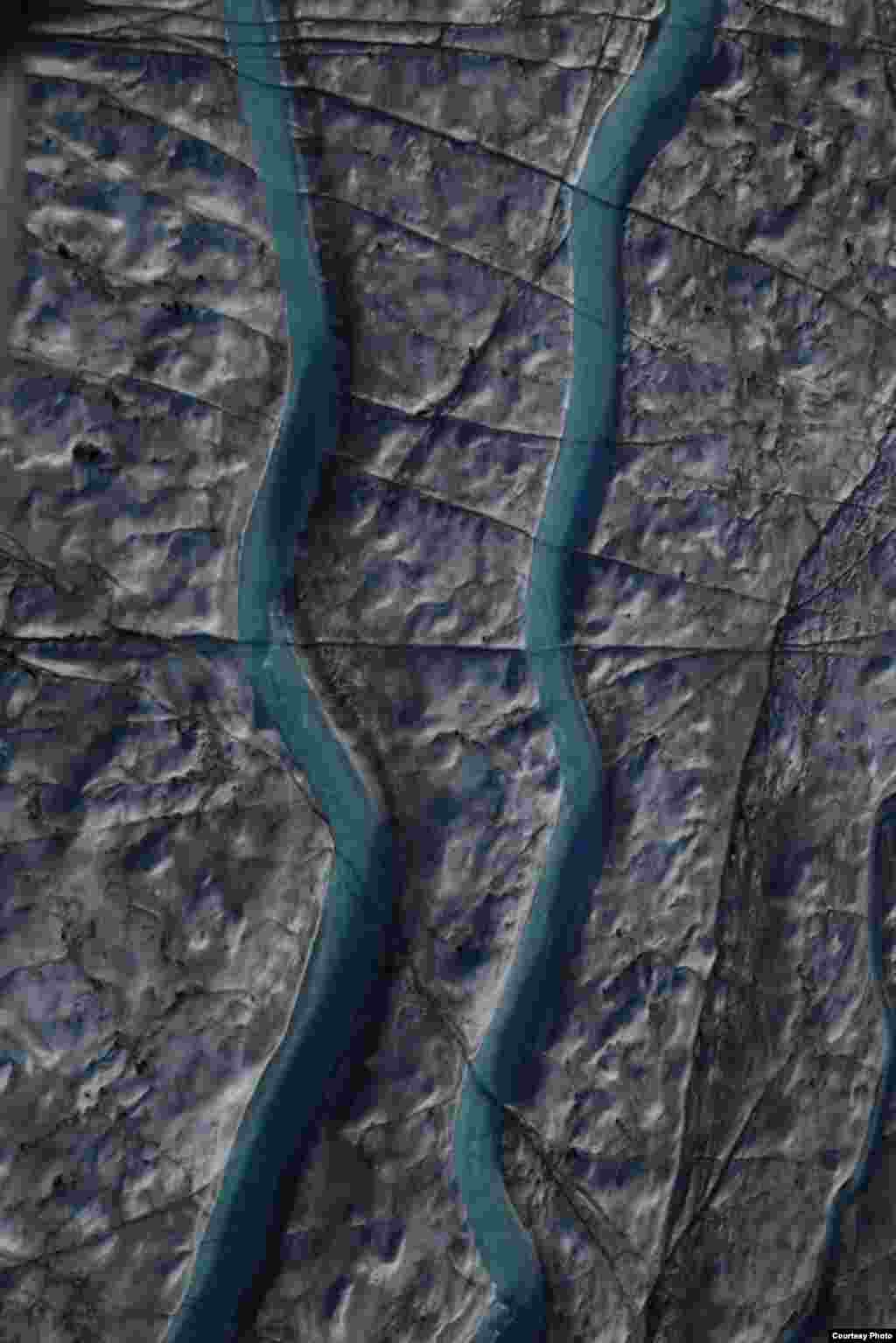
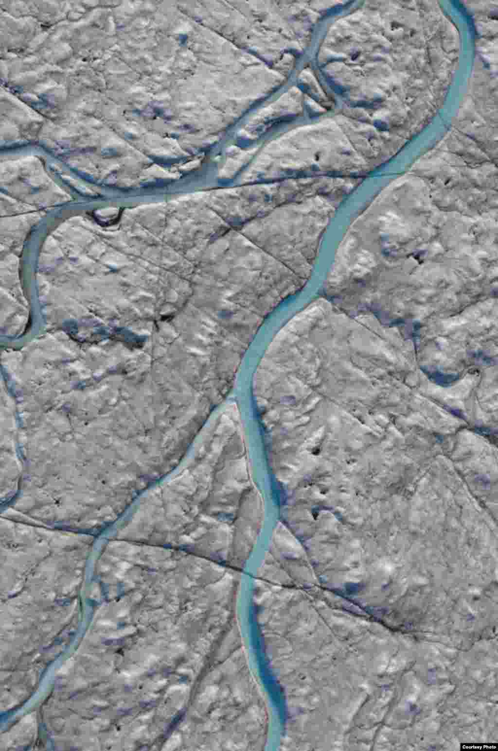
The UCLA-led team mapped 523 supraglacial rivers, which flow across the top of glaciers. These drained meltwater from a 5,000 square kilometer area of southwest Greenland after an extreme melt event in 2012. (UCLA/Laurence C. Smith)
8
When snow and ice melt during the summer months, waterways like this one form an intricate drainage system that captures virtually all surface runoff. (UCLA/Laurence C. Smith)