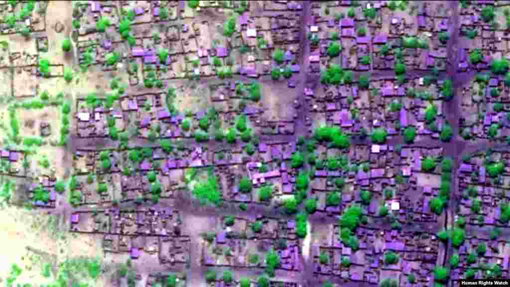
A total of 2,275 destroyed and 125 severely damaged buildings were identified within the town of Baga (Borno State, Nigeria) based on a change detection analysis of two high resolution satellite images collected on the mornings of April 6, before the violence, and April 26, 2013, after the violence.
Satellite Images of Damage in Baga, Nigeria
5
Pre-violence view of concentration of building damages (view 3). Satellite imagery displayed in false-color, near-infrared to highlight areas of extensive fire-related damages and burn scars.
6
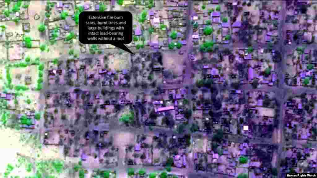
Post-violence view of concentration of building damages (view 3). Extensive fire burn scars, burnt trees and large buildings with intact load-bearing walls without a roof are seen.